

My part of London as it used to be
One of the old favourites on my bookshelf is a book I gave to my father many years ago and ultimately inherited, the Village London Atlas: Changing Face of Greater London, 1822-1903 (The village atlas), by the Village Press.
The Village London Atlas is designed to show, area by area, the growth of Greater London during the Victorian era, using the Ordnance Survey maps of 1822, 1860 and 1902 (and their revisions) ranged in a series of sets of three double-page spreads. By a turn of the page they reveal the geography of London over a very rapid and interesting period of change. Old placenames, roads, routes of canals and the coming of suburbia and the rail network are all revealed.
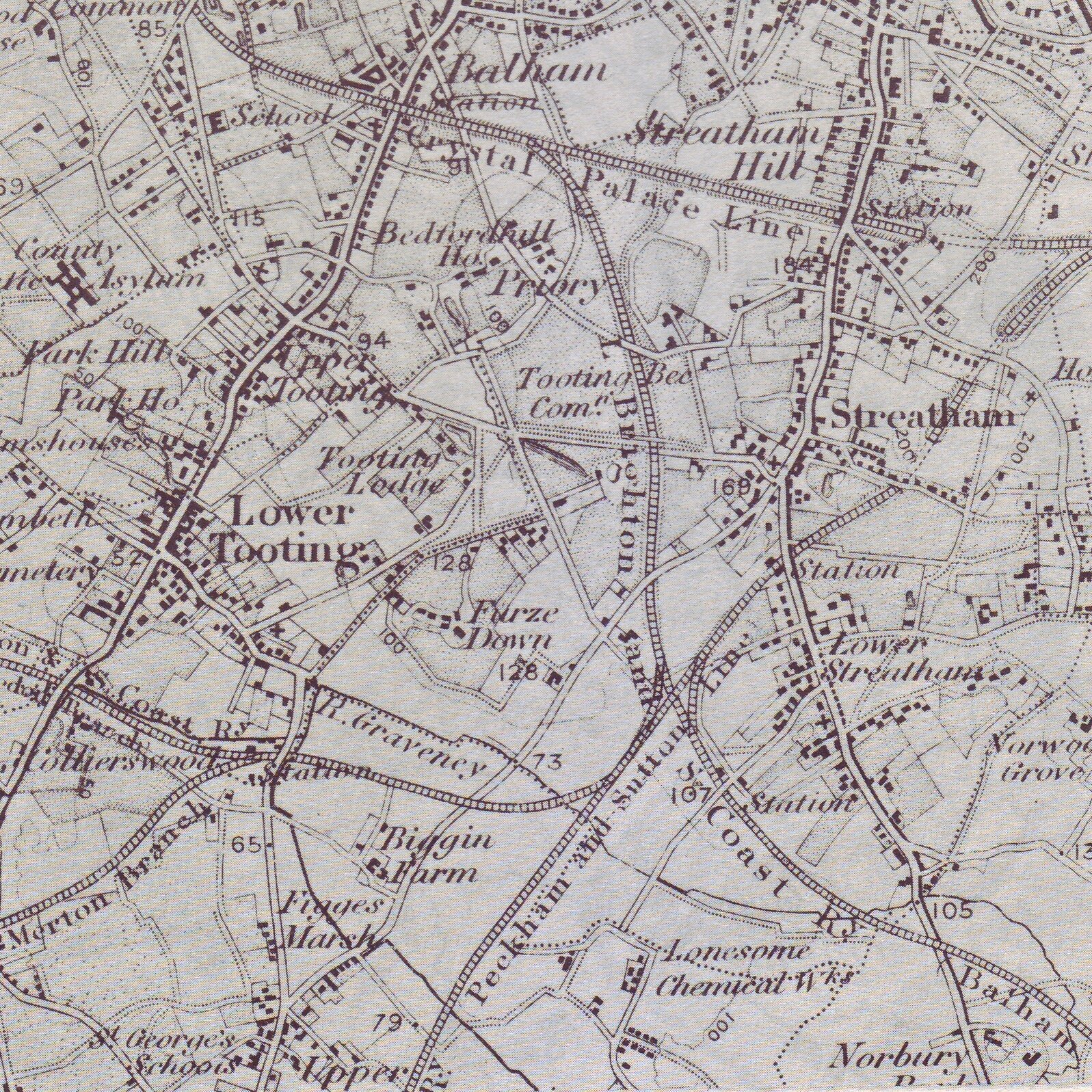
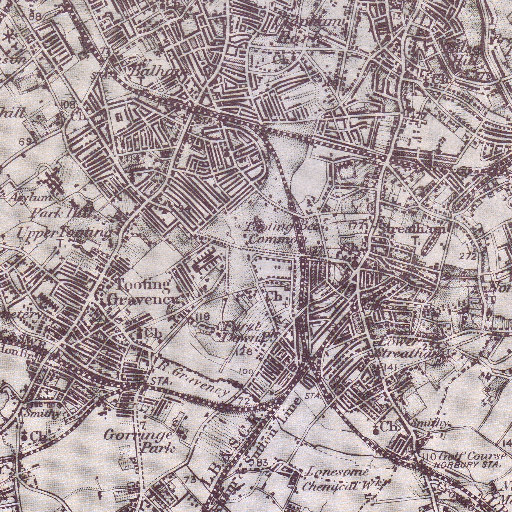
These three maps show the same part of South West London - a rough triangle encompassing Tooting, Streathamand Balham, which is the triangle within which I have lived for the past 17 years. The maps are from 1816, 1871 and 1902 respectively.
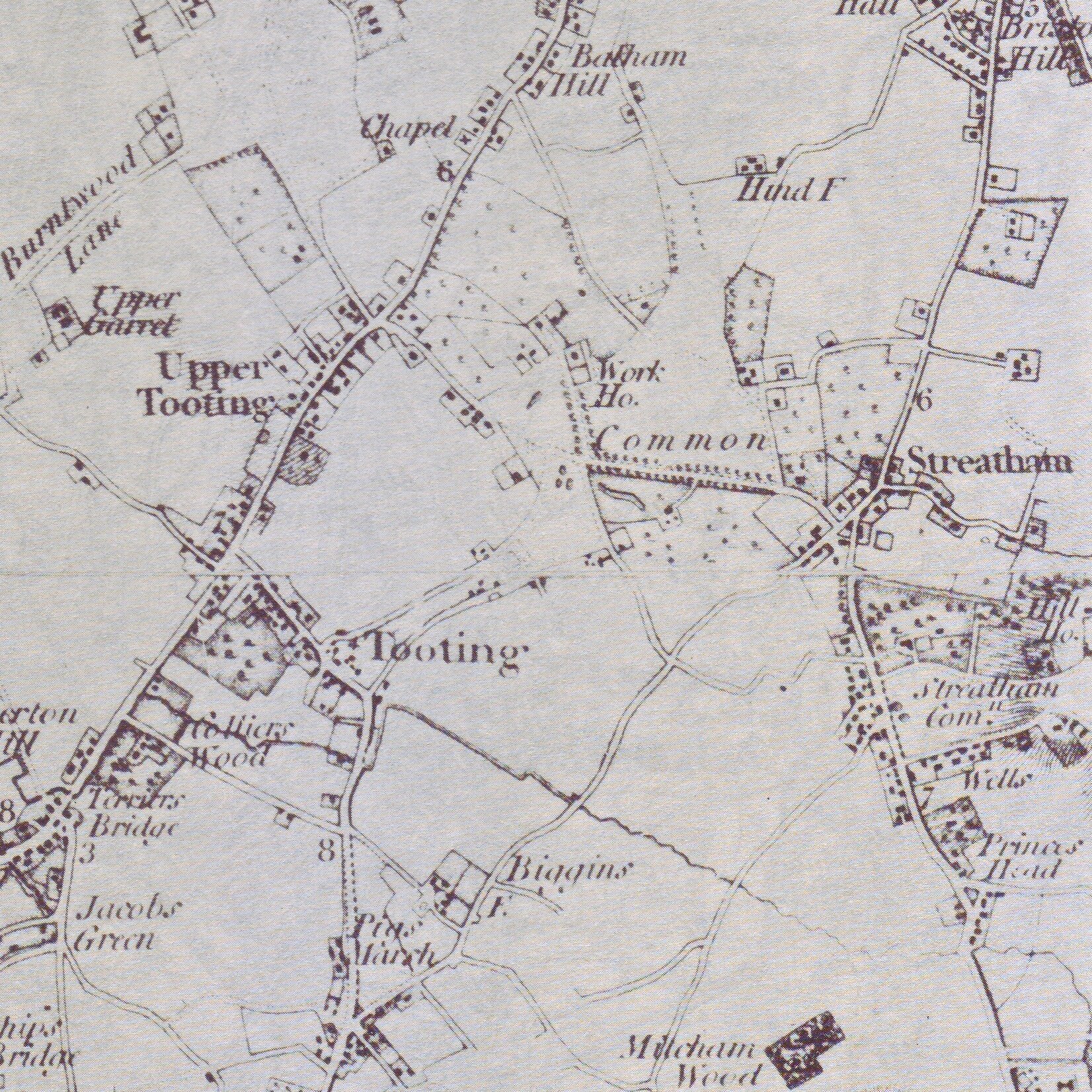
1816. No Trinity Road (now the major trunk road in the area) leading from Upper Tooting (now Tooting Bec) to Wandsworth, and not very much between Tooting and Streatham. It was all just fields round here.
1871. My house is still not there, but the railways have come and with them has come urbanisation. Not also the Lonesome Chemical Works at centre-bottom.
1902. My street is on the map (circa 1899) but my house was completed in 1904. There are a few gaps still. The chemical works are still Lonesome.